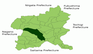
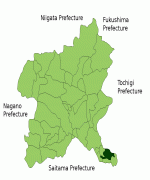
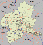
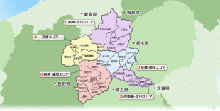
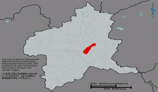
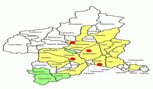
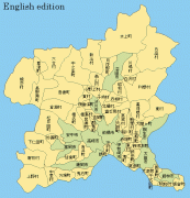
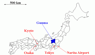
Gunma Prefecture (Gunma-ken)
 |
Maebashi is the capital and Takasaki is the largest city of Gunma Prefecture, with other major cities including Ōta, Isesaki, and Kiryū. Gunma Prefecture is one of only eight landlocked prefectures, located on the northwestern corner of the Kantō Plain with 14% of its total land being designated as natural parks.
The ancient province of Gunma was a center of horse breeding and trading activities for the newly immigrated continental peoples. The arrival of horses and the remains of horse tackle coincides with the arrival of a large migration from the mainland. From this point forward, the horse became a vital part of Japanese military maneuvers, quickly displacing the older Yayoi tradition of fighting on foot.
When Mount Haruna erupted in the late 6th century, Japan was still in the pre-historical phase (prior to the importation of the Chinese writing system during the Nara period). The Gunma Prefectural archaeology unit in 1994 was able to date the eruption through zoological anthropology at the corral sites that were buried in ash.
In the past, Gunma was joined with Tochigi Prefecture and called Kenu Province. This was later divided into Kami-tsu-ke (Upper Kenu, Gunma) and Shimo-tsu-ke (Lower Kenu, Tochigi). The area is sometimes referred to as Jomo (上毛, Jōmō). For most of Japanese history, Gunma was known as the province of Kozuke.
In the early period of contact between western nations and Japan, particularly the late Tokugawa, it was referred to by foreigners as the "Joushu States", inside (fudai, or loyalist) Tokugawa retainers and the Tokugawa family symbol is widely seen on public buildings, temples, and shrines.
The Tenmei eruption of Mount Asama occurred in 1783, causing enormous damage.
The first modern silk factories were built with Italian and French assistance at Annaka in the 1870s.
In the early Meiji period, in what was locally called the Gunma Incident of 1884, a bloody struggle between the idealistic democratic westernizers and the conservative Prussian-model nationalists took place in Gunma and neighboring Nagano. The modern Japanese army gunned down farmers with new repeating rifles built in Japan. The farmers in Gunma were said to be the first victims of the Murata rifle.
In the twentieth century, the Japanese aviation pioneer Nakajima Chikushi of Oizumi, Gunma Prefecture, founded the Nakajima Aircraft Company. At first, he produced mostly licensed models of foreign designs, but beginning with the all-Japanese Nakajima 91 fighter plane in 1931, his company became a world leader in aeronautical design and manufacture, with its headquarters at Ota, Gunma Ken. The factory now produces Subaru motorcars and other products under the name of Subaru née Fuji Heavy Industries.
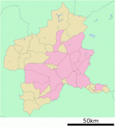
Map - Gunma Prefecture (Gunma-ken)
Map


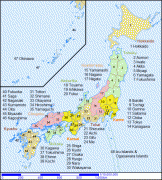
Country - Japan
 |
 |
| Flag of Japan | |
Japan is the eleventh most populous country in the world, as well as one of the most densely populated and urbanized. About three-fourths of the country's terrain is mountainous, concentrating its population of 124.8 million on narrow coastal plains. Japan is divided into 47 administrative prefectures and eight traditional regions. The Greater Tokyo Area is the most populous metropolitan area in the world, with more than 37.2 million residents.
Currency / Language
| ISO | Currency | Symbol | Significant figures |
|---|---|---|---|
| JPY | Japanese yen | ¥ | 0 |
| ISO | Language |
|---|---|
| JA | Japanese language |
